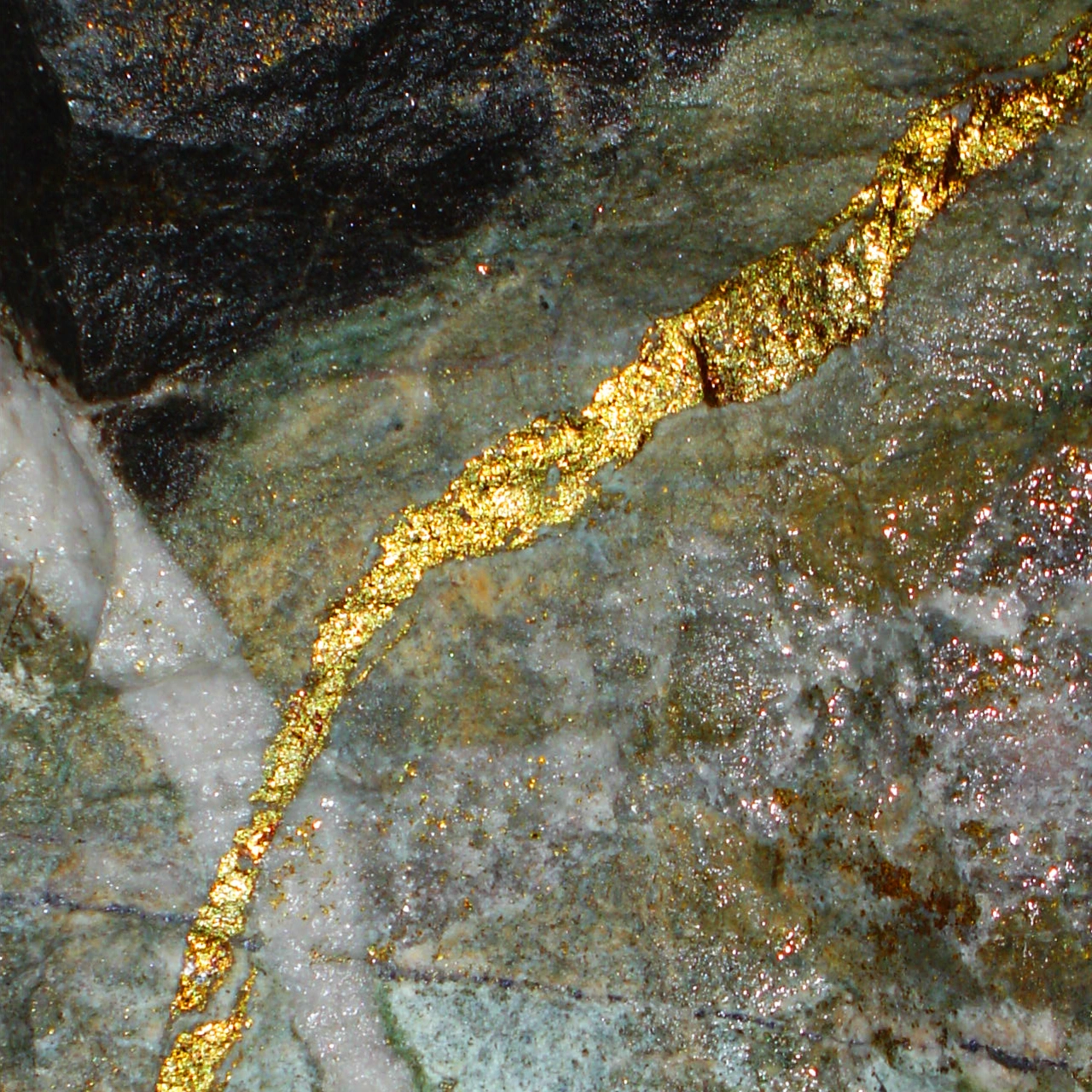
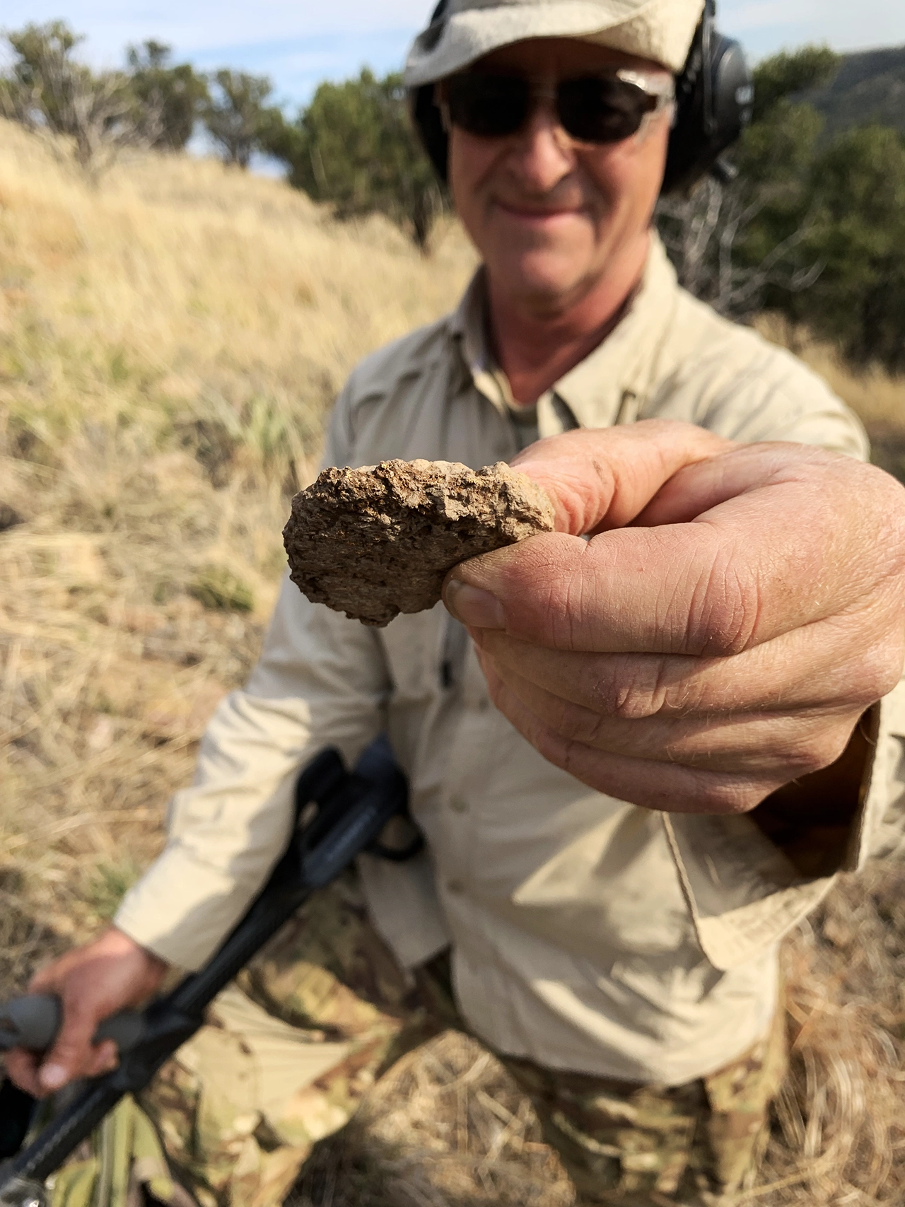
When gold veins are exposed to surface weathering, they can become detectiable nuggets.
Treasure From Outer Space
The geology of gold here on Earth began a long time ago in a galaxy far, far away. Gold was actually created billions of years ago during massive star explosions (supernovas), of neutron star collisions. When the solar system formed, this gold mixed with cosmic dust and rock. Later meteorite and asteroid impacts delivered additional gold to Earth’s surface after the planet’s core had already formed. Ta-da, treasure from space.
Interest… yes, but it doesn’t help us where to detect for nuggets. The geologic processes of how “free gold” formed in veins within hydrothermal precipitated quartz, then later exposed and eroded into nuggets is a complicated process that took millions of years.
The bottom line is that this “cosmic gold” in nugget form can be found using your detector. And your chances of finding them increase dramatically by detecting in the best places. Although we won’t share our secret spots, we can offer some advice on how to narrow your search to higher percentage places in your secret spots.
The Physics of Density
Gold is one of the densest metals on Earth, at about 19.32g/cm³ (grams per cubic centimeter.) This means for every 1 cm³ of gold, there is 19.32g of it.
Let’s put that density into serious perspective. Imagine that you’re holding a one-gallon jug in each hand. The jug filled with water weighs8.34 pounds. No problem, right? In your other hand, we suddenly fill it with gold… that gallon now weighs 161 pounds! And chances are you can’t hold that jug any longer.
It’s gold’s incredible density combined with physics of geomorphology (explained below) that can guide you on where to focus your detecting in gold country. So here’s the rundown on what’s considered “gold country” in the U.S.
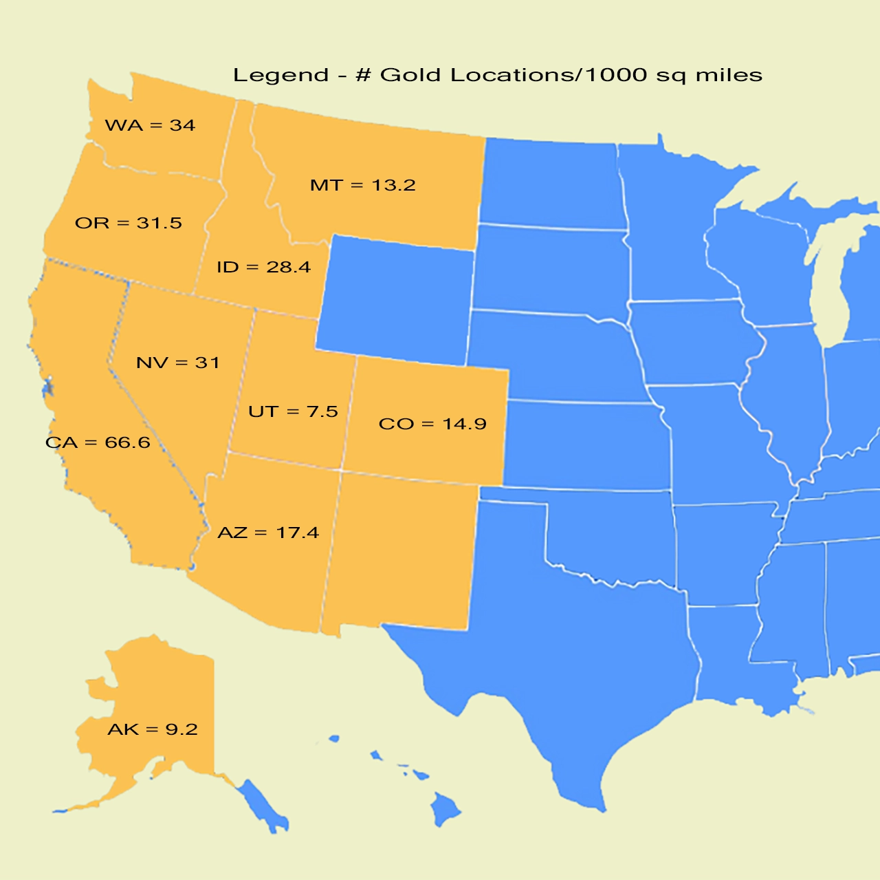
The Internet is a gold-mine of information and videos on what states and regions to detect for gold. Out of all 50 states, 32 atually have gold in them and here are the top 10 with the most gold-producing locations relative to their geographic size:
California – 66.59 locations per 1,000 square miles
Washington – 34.17 locations per 1,000 square miles
Oregon – 31.41 locations per 1,000 square miles
Nevada – 30.91 locations per 1,000 square miles
Idaho – 28.44 locations per 1,000 square miles
Arizona – 17.40 locations per 1,000 square miles
Colorado – 14.89 locations per 1,000 square miles
Montana – 13.21 locations per 1,000 square miles
Alaska – 9.22 locations per 1,000 square miles
Utah – 7.46 locations per 1,000 square miles
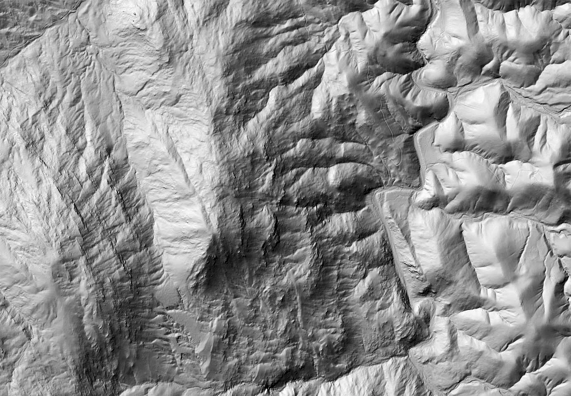
This is an actual "enhanced" LiDAR map we created in one of our nugget detecting areas that reveal a ton of likely places (erosional unconformities) to set our detectors to "gold"
Physics of Geomorphology
Now let’s use gold’s density in combination with the physics of geomorphology to give us clues on where to detect on the landscape.
And visualizing this simple yet key concept is vital on where to detect. When gold-bearing topography erodes downward over eons, the heaviest material (gold) settles to the bottom and is the most likely material to become trapped in an erosional or geologic unconformity.
These erosional or geologic unconformities that can trap gold nuggets could be:
A crack in a rock layer (often bedrock)
A ledge or dramatic change in the slope of topography
An outcrop or ridge of rock
A layer of “sticky” clay or layer of irregular broken rocks
Of course for us to find nuggets with our detectors, these gold-trapping places need to be exposed at or very near our “present-day” surface. Now before you shout, “Hold on, how can I find those places?” Use the power of LiDAR and “enhanced” LiDAR that you learned in Lesson 5 – Working With LiDAR, to give you a head start before you every leave home.
Plus, give you an actual visual understanding of these types of places look like on the ground, we’ve included some excellent nugget detecting YouTube channel links in our References section.
Fortunately, we all don't have to become geologists to find nuggets if we're armed with a basic understanding of where to look with our detectors. Our gold specialist, Ed, detected this "3-ounce cookie" nugget below a quartz ridge in the "dropout zone" where the slope became flatter.
Good Ole Common Sense
Besides using some of the tips on this site and the knowledge from gold detecting videos, don’t overlook your own superpower of common sense. Here’s a list to consider when researching, exploring maps, or navigating the topography (hiking around):
Look for gold where gold has been found (research first)
Look for nuggets down slope or down drainage from where gold has been found (mined)
Gold veins eroded into nuggets tens of millions of years ago. So erosional “bedrock” (base geologic layer) are prime places
You can often spot “exposed bedrock” at the surface before you go by using Google Earth Pro
Nuggets in creek and ravine bottoms are often covered with too much sediment to detect (unless that bottom is exposed bedrock)
Erosional unconformities that are “perpendicular” (90 degrees) to the drainage slope can create “traps” for denser material
Permission to detect for nuggets requires that you research if the area is “claimed”.
Joining gold detecting clubs (national-state-regional) can get you access to detect on claims in nugget producing areas