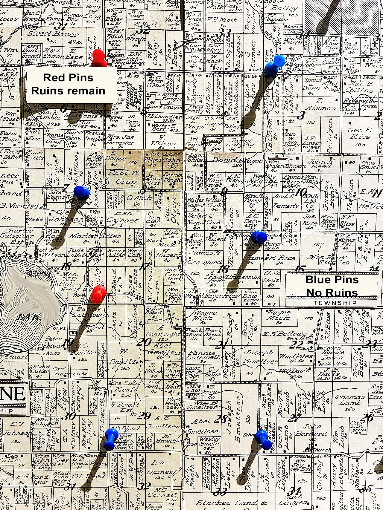
This paper map of 1880's school house locations pinned on a 1960's plat map was taken in a local hisotrical museum with a cell phone. Combined with modern maps, it pinpoints a number of sites to... get permission on (that's another section)
Capture - Sort - Save
If you’ve gotten this far, you hopefully have a computer to capture, sort, and save the maps, photos and other clues you’ve uncovered. So let’s start with a few pointers that can help you “capture” your images.
If you’re in a history center or library where they are images are maps on display, use your smartphone to grab some photos. Then transfer them to your computer.
If your online searches produce websites where you can download maps or photographs, then download the highest resolution available. If they offer formats besides JPEG, opt for PNG if available. If you’ve made a deep dive into the history, you’ll likely have collected a bunch of different kinds of files to sort and save.
When saving your clues, consider sorting and saving using a filing structure that makes sense to your detecting interests and will help in keeping track of everything and in making map overlays later on. Here’s a logical outline of how you might save and sort:
County > Township
Logging Camps
Camp #1 Name
Maps
Photos
Documents
Ghost Towns
G #1 Town Name
Maps
Photos
Documents
This may look like “sorting overkill”, but it can save you the frustration of searching for a key map that was filed in the wrong folder… we know.
Because old railway crossings helped create town sites that later turned into ghost towns, old railway maps can help in locating past sites of hotels, stores, depots and post offices.
Detailed Maps & Documents
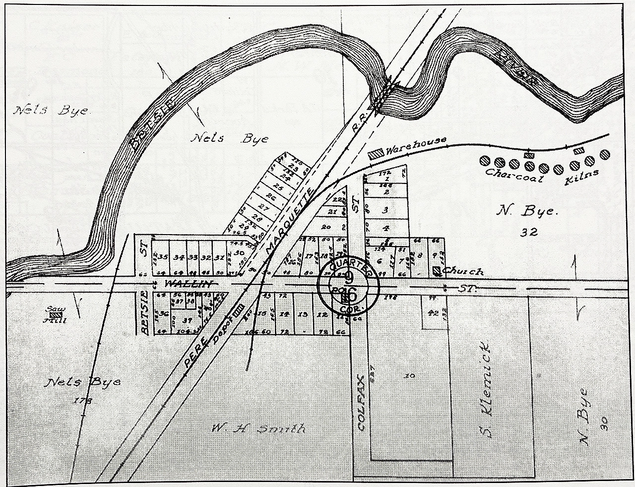
Hopefully your searches will discover detailed maps such at the one to the left. It shows the platted locations of an 1800’s ghost town that was completely destroyed by fire in 1895. The historic record noted that only the church remained untouched.
Research also turned up old news articles, photographs and historic documents that helped pinpoint the relative geographic location of the general store and railroad depot… two high-target sites.
Using this plat with “scale corrected” overlays of LiDAR, Google Earth Pro, and country land ownership maps for getting permissions, our detectorists were all set to explore the sites.
Detailed maps such as this one can also help you align the right geographic position (N-S-E-W) of past structures… which can help you detect on “the right side” of the tracks. Knowing if you’re detecting the front or backside of train depots and other buildings can make a difference between digging rusty nails or silver coins.