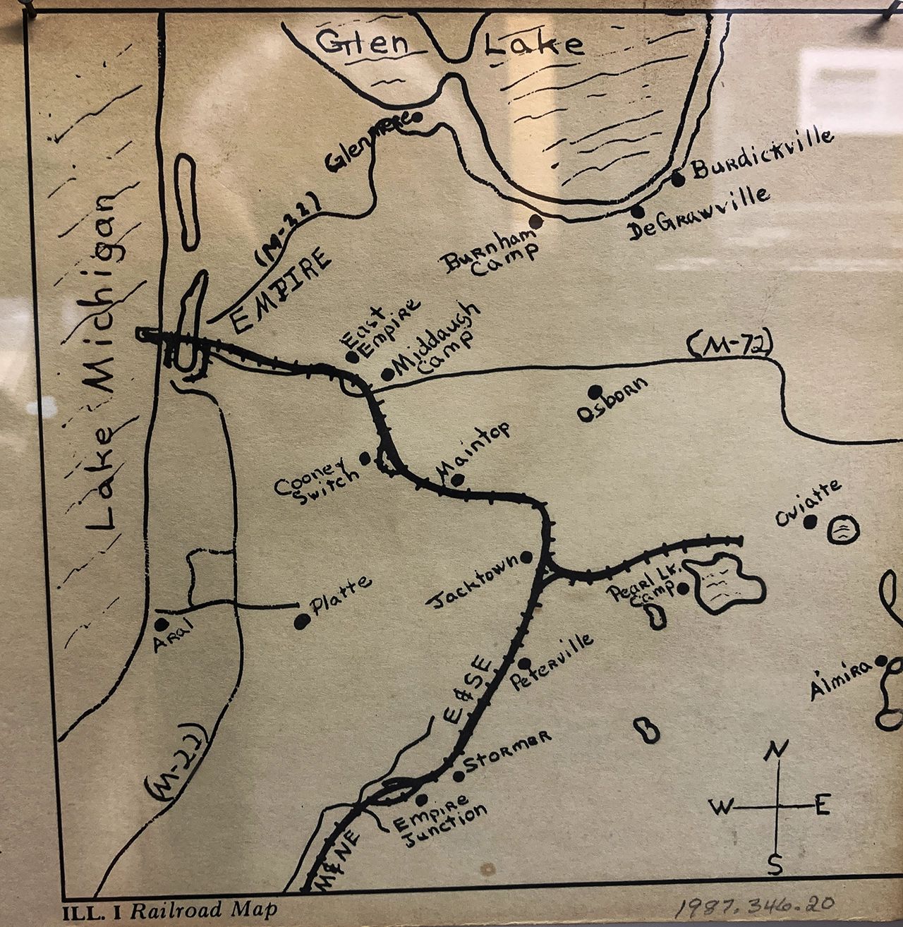
This 1800's hand-drawn map was correlated to modern maps and LiDAR images to pinpoint long-lost ghost towns, lumber camps, train stations, switching rails, swimming places and even a shipping port.
Maps... Old Maps
The three main types of archives that offer you clues to detecting sites are old maps, photos, and news articles.
Maps, really old maps, are the best place to start as they can reveal a surprising variety of potential sites to match your detecting interest and help refine your search.
For instance, some show long-abandon lumber camps or post offices while others might reveal the past locations of ghost towns, churches and schoolhouses. A common challenge however is pinpointing the accurate location of your prospect sites relative to modern maps. So you’ll want to correlate various “time-relative” versions of the site area using maps from older to newer. In the other sections we’ll cover how to record the maps then create overlays to pinpoint the site relative to maps on your computer and smartphone.
In fact, the header at the top of this page was created from a cell phone photo of an actual 1800’s hand-drawn map of pencil on a paper bag that helped reveal early railway junctions and even a couple of ghost towns… that were pinpointed with enhanced LiDAR and produced some artifacts
Logical places to focus on are where travelers lingered. The sandy soil here almost invited silver coin drops. In fact an era silver dollar was detected here!
Historic Photographs
Besides maps, online historical photographs can show remarkable clues on where to narrow your search for lost treasure.
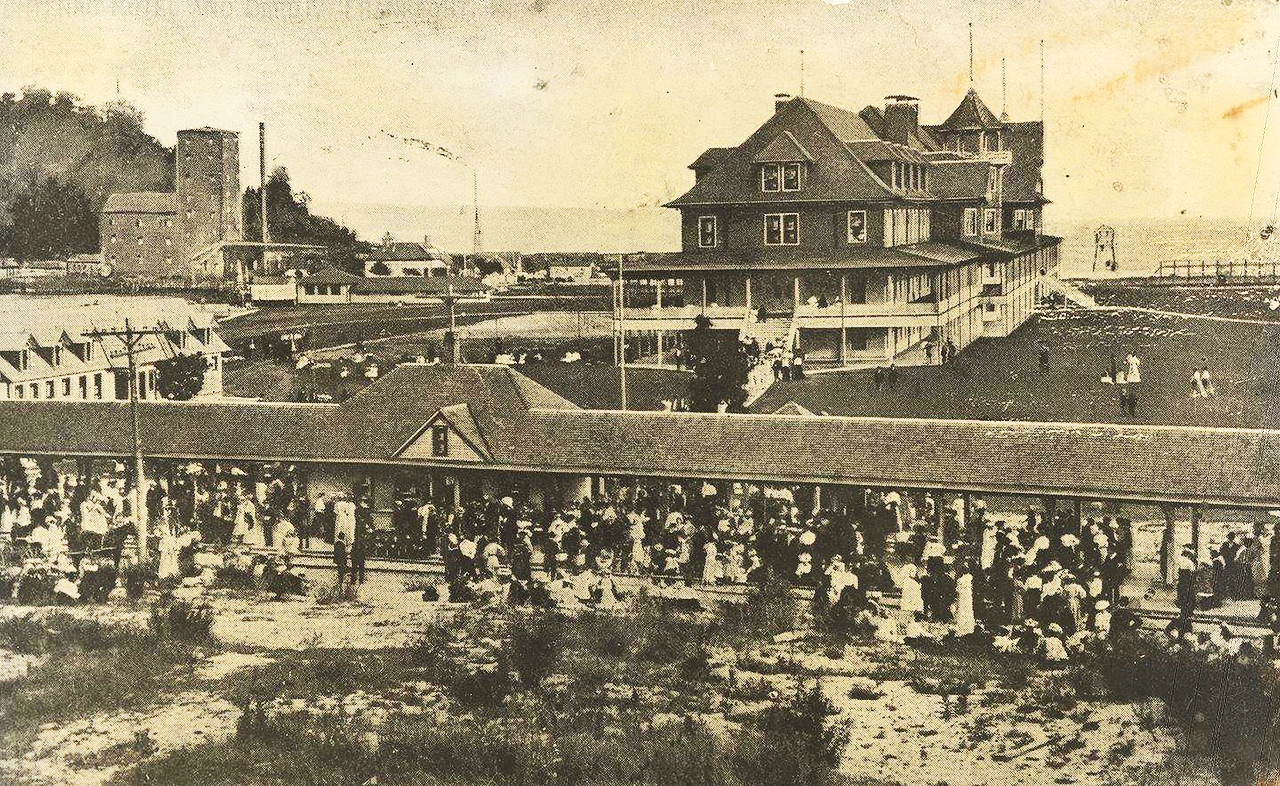
For instance, an 1870 map showed the location of this “end-of-the-line train” depot. Then a 1902 photo to the left shows the location alignment of that tourist-jammed depot station and where people walked over to a famous three-story hotel with 250 rooms that burned to the ground in 1912. The train tracks, depot and hotel are all long gone, but comparing the photo with old maps helped pinpoint prime places to detect for vintage silver coins.
Because old hotels used fire to light and heat them, a surprising number burned and we’re recorded with photos or in old newspapers. Other “misfortunes” that could offer detecting sites include train wrecks, grounded shipwrecks (an estimated 6,000 wrecks in the Great Lakes), and hundreds of abandoned businesses that shuttered during the economic “panic of 1895”.
At this point you’re probably starting to feel like a historic detective. So let’s consider digging deeper into the clues with old news clippings.
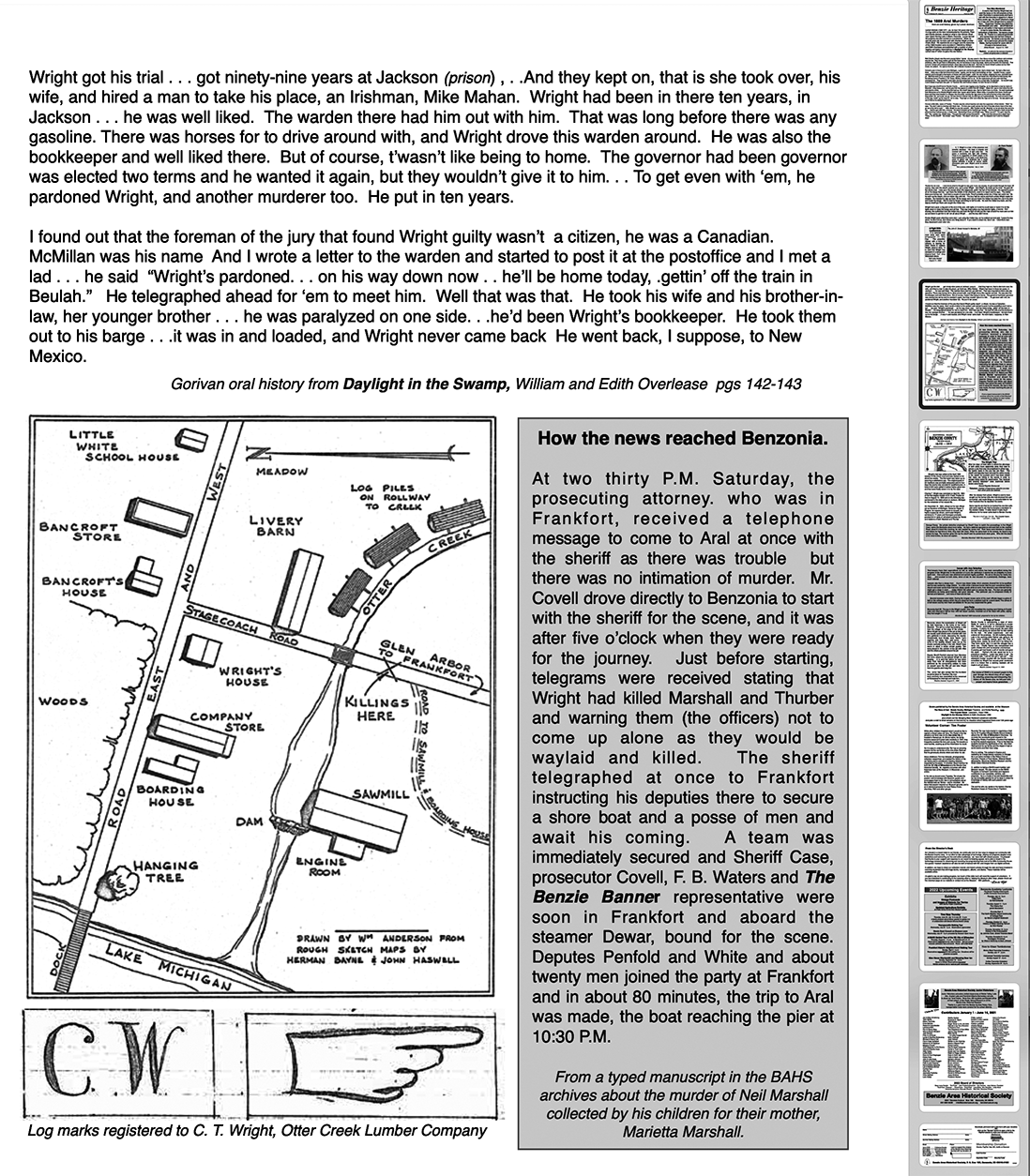
At one time this site was a bustling lumber town. A double murder back in 1899 lead to the town being abandoned. Today, there's nothing there except a vast forest... and some faint impressions where LiDAR pins the building locations.
Details in Old News Articles
So let’s say that your maps and photographs identified some interesting sites that look promising… at least on your computer screen. One last source of clues to explore are historic news articles. They may be available online at the historical societies or libraries that we mentioned. But another source is the actual news paper archives… especially if they have them online with a search feature.
The image to the left is a recreated news bulletin using several old news articles and actual accounts about a small town that was abandoned after a double murder. We’ll use this ghost town example later on in the Mapping Your Sites and Working With LiDAR sections.
Just like today, historic news articles often covered “unfortunate” events, many that can lead to interesting sites. For instance, our team of historic sleuths discovered a number of 1800’s hotel and dance hall fires where dozens of patrons lost valuables, including gold coins.
If you can’t locate any news archives, don’t overlook clues readily available on the Internet. In fact, take a moment to search for ghost towns or historic fires in your state or county. Many states will list dozens and some over 100.
What in the heck do you do with all these clues? We'll put order to the chaos in the next section...